

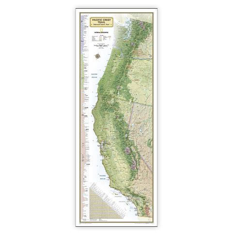
National Geographic Pacific Crest Trail Map, Laminated, 18in x 48in MPN:NGMRE01020759
Discount: See in Cart
Free Shipping
In Stock
Free Shipping
In Stock
SKU
312-7820886
National Geographic Pacific Crest Trail Map, Laminated, 18in x 48in MPN:NGMRE01020759
Navigate the Pacific Crest Trail like a pro with National Geographic's expertly researched map. Ideal for hikers and fans of this 2,600+ mile National Scenic Trail, this map makes a great planning tool or reference to track progress. The entire trail is depicted from Mexico to Canada, with a unique elevation profile highlighting peaks and valleys, and an informative mileage chart showing distances between key locations. Also featured are passes, peaks, national forests, parks, and Indian reservations, as well as lodges and campgrounds near the trail. Perfect for planning your next adventure or tracking your progress, this map is a must-have for any Pacific Crest Trail enthusiast.
Top product features:
- Expertly researched and designed map of the Pacific Crest Trail
- Elevation profile highlights the trails peaks and valleys
- Informative mileage chart shows the distance between key locations
Top product applications:
- Planning tool for the Pacific Crest Trail
- Reference map for tracking progress on the 2,600 plus mile length
- Decorative wall map for fans of the Pacific Crest Trail
Expertly researched and designed, National Geographics map of the Pacific Crest Trail is ideal for fans and hikers of this magnificent National Scenic Trail. It makes a great planning tool or as reference to track progress on the 2,600 plus mile length. This beautiful map shows the entire length of the trail from Mexico to Canada through California, Oregon, and Washington. A unique elevation profile highlights the trails peaks and valleys, and an informative mileage chart shows the distance between key locations. Also highlighted on this map are passes, peaks, national forests, national parks, state parks, and Indian reservations. Additional points of interest include lodges and campgrounds near the trail. The map is encapsulated in heavy-duty 1.6 mil laminate which makes the paper much more durable and resistant to the swelling and shrinking caused by changes in humidity. Laminated maps can be framed without the need for glass, so the frames can be much lighter and less expensive. Measures 18in x 48in.
Additional Information
- Country of Origin: US
- UNSPSC Code: 60101721
- UNSPSC Commodity: Professional teacher resource books
- Green: No
- Recycled Content: FALSE
- Hazardous: No
- Prop 65: No
- MSDS URL: nan
- Package Length: 25.00
- Package Width: 2.00
- Package Height: 2.00
- Package Weight: 0.25
Product info last updated on February 11, 2026 5:13pm UTC
Category: Instructional Resources