

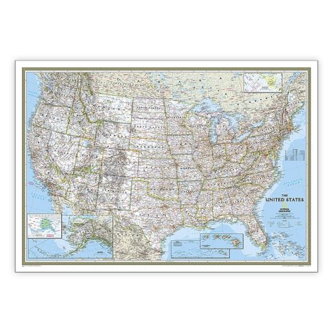
National Geographic United States Classic Map, Laminated, 43.5in x 30.5in MPN:NGMRE00620411
Discount: See in Cart
Free Shipping
In Stock
Free Shipping
In Stock
SKU
312-7014120
National Geographic United States Classic Map, Laminated, 43.5in x 30.5in MPN:NGMRE00620411
Elevate your space with the National Geographic United States Classic Map, a beautifully designed and expertly researched wall map that's the standard by which other reference maps are measured. Perfect for home, office, or classroom use, this laminated map features a bright, easy-to-read color palette, clearly defined state and country boundaries, and thousands of place names. Its durable laminate coating makes it resistant to humidity changes and easy to frame without glass. Ideal for educators, students, and history buffs, this map is a valuable resource for learning and exploration, and a stunning addition to any room.
Top product features:
- Expertly researched and designed, providing accurate and reliable information
- Signature Classic styling with a bright, easy to read color palette
- Encapsulated in heavy-duty 1.6 mil laminate for durability and resistance to humidity changes
Top product applications:
- Home Decor
- Office Use
- Educational Settings
Expertly researched and designed, National Geographics United States wall map is the standard by which other reference maps of the U.S. are measured. Signature Classic styling with bright, easy to read color palette with blue water and colorful state borders. All 50 states with insets for Hawaiian Islands and Alaska plus inset showing relative size of Alaska. Clearly defined state and country boundaries, cities, islands, national parks, and physical features. Thousands of place names carefully and artfully placed to maintain legibility in heavily populated areas. Background shows mountain ranges and valleys in subtle shaded relief with mountain ranges labeled. Major water bodies including rivers, lakes, gulfs, bays, straits, and ocean bathymetry. Transportation routes including interstate highways, major state routes, airports, waterways, canals, and ferries. The map is encapsulated in heavy-duty 1.6 mil laminate which makes the paper much more durable and resistant to the swelling and shrinking caused by changes in humidity. Laminated maps can be framed without the need for glass, so the frames can be much lighter and less expensive. Measures 43.5in x 30.5in.
Additional Information
- Country of Origin: US
- UNSPSC Code: 60101721
- UNSPSC Commodity: Professional teacher resource books
- Green: No
- Recycled Content: FALSE
- Hazardous: No
- Prop 65: No
- MSDS URL: nan
- Package Length: 37.00
- Package Width: 2.00
- Package Height: 2.00
- Package Weight: 0.38
Product info last updated on February 11, 2026 5:14pm UTC
Category: Instructional Resources