

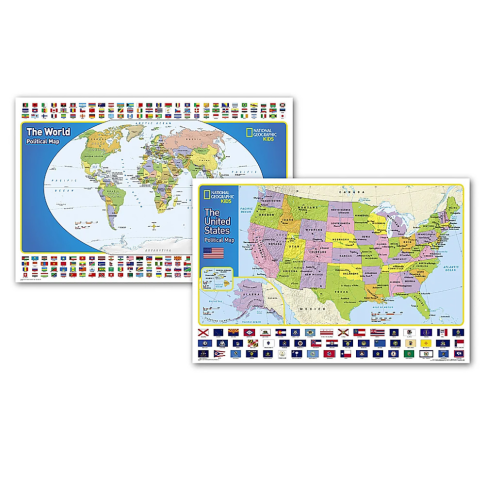
National Geographic World and United States for Kids, Poster Size, Map Pack Bundle, 36in x 24in MPN:NGMRE01021233B
Discount: See in Cart
Free Shipping
In Stock
Free Shipping
In Stock
SKU
312-3673332
National Geographic World and United States for Kids, Poster Size, Map Pack Bundle, 36in x 24in MPN:NGMRE01021233B
Elevate your educational experiences with the National Geographic World and United States for Kids Map Pack Bundle. Perfect for classrooms, homes, and libraries, these engaging and optimized maps are designed for intuitive learning and readability. Featuring 195 independent countries and their official flags, these maps are ideal for geography education, promoting cultural awareness and spatial understanding. The World Map's Winkel Tripel projection minimizes distortions, while the United States Map showcases the country's geography in a clear and concise manner. Use them for teaching, research, or simply for inspiration, these maps are an essential reference tool for kids aged 7-12.
Top product features:
- The World and United States for Kids Map Pack includes two maps that are optimized for readability and easy, intuitive learning.
- The maps feature all 195 independent countries and their official, colorful flags arranged in alphabetical order for ease-of-use.
- The World Map is drawn in the Winkel Tripel projection, which minimizes distortions and provides an accurate representation of the world.
Top product applications:
- Classroom decoration
- Home educational tool
- Library resource
National Geographics The World for Kids and United State for Kids wall maps are enticing and engaging world and United States maps perfect for classroom, home or library. Recommended by geography educators for ages 7-12, these maps feature an optimized map design for readability and easy, intuitive learning. All 195 independent countries and their official, colorful flags are represented and arranged in alphabetical order for ease-of-use. Expertly researched, The World for Kids and United States maps are essential reference tools for todays interesting geographical world. The World Map is drawn in the Winkel Tripel projection, distortions are minimized and unlike many other World maps, Greenland is show the same size as Argentina and not as the size of all of South America. The World and United States for Kids Map Pack Includes: World Classic Map [Poster Size] and United States Classic Map [Poster Size]. These maps are packaged in a two inch diameter clear plastic tube. The tube has a decorative label showing a thumbnail of the maps with dimensions and other pertinent information. Measures 36in x 24in.
Additional Information
- Country of Origin: US
- UNSPSC Code: 60101721
- UNSPSC Commodity: Professional teacher resource books
- Green: No
- Recycled Content: FALSE
- Hazardous: No
- Prop 65: No
- MSDS URL: nan
- Package Length: 32.00
- Package Width: 2.00
- Package Height: 2.00
- Package Weight: 0.25
Product info last updated on February 11, 2026 5:13pm UTC
Category: Instructional Resources