

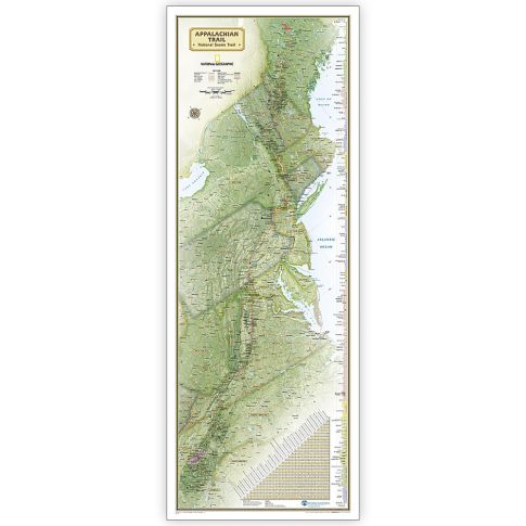
National Geographic Appalachian Trail Map, In Gift Box, 18in x 48in MPN:NGMRE01020716X
Discount: See in Cart
Free Shipping
In Stock
Free Shipping
In Stock
SKU
312-3481801
National Geographic Appalachian Trail Map, In Gift Box, 18in x 48in MPN:NGMRE01020716X
Elevate your appreciation for the Appalachian Trail with this stunning National Geographic map, expertly researched and designed in cooperation with the Appalachian Trail Conservancy. Perfect for fans and hikers, this 18in x 48in map serves as a valuable planning tool or reference to track progress on the 2,200-mile journey. Unique elevation profiles highlight peaks and valleys, while an informative mileage chart shows distances between key locations. Ideal for gift giving or personal use, this beautifully packaged map showcases National Forests, National Park Service lands, and major highways, making it a must-have for outdoor enthusiasts and nature lovers.
Top product features:
- Expertly researched and designed to provide detailed information about the Appalachian Trail.
- A unique elevation profile highlights the trails peaks and valleys.
- An informative mileage chart shows the distance between key locations.
Top product applications:
- Decorating a home or office with a unique and educational piece of art
- Planning a trip or hike along the Appalachian Trail
- Gift-giving for outdoor enthusiasts or nature lovers
Expertly researched and designed, National Geographics map of the Appalachian Trail is ideal for fans and hikers of this magnificent national scenic trail. It makes a great planning tool or as reference to track progress on the 2,200 mile length. Developed in cooperation with the Appalachian Trail Conservancy, this beautiful poster, shows the entire length of the trail from Maine to Georgia. A unique elevation profiles highlight the trails peaks and valleys and an informative mileage chart shows the distance between key locations. Also highlighted on the map are National Forests, National Park Service lands, State Forests and Parks, and major highways and interstates. Points of interest include Appalachian Trail information centers and shelters. The map is packaged in a full color box designed for gift giving. The box includes a large image of a section of the map inside and details including size and scale. Measures 18in x 48in.
Additional Information
- Country of Origin: US
- UNSPSC Code: 60101721
- UNSPSC Commodity: Professional teacher resource books
- Green: No
- Recycled Content: FALSE
- Hazardous: No
- Prop 65: No
- MSDS URL: nan
- Package Length: 20.00
- Package Width: 2.50
- Package Height: 2.50
- Package Weight: 0.19
Product info last updated on February 11, 2026 5:14pm UTC
Category: Instructional Resources