

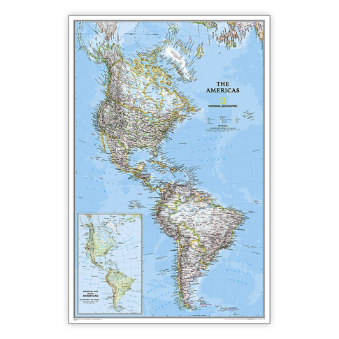
National Geographic The Americas Classic Map, Laminated MPN:NGMRE00620152
Discount: See in Cart
Free Shipping
In Stock
Free Shipping
In Stock
SKU
312-4648080
National Geographic The Americas Classic Map, Laminated MPN:NGMRE00620152
Explore the diverse terrain of The Americas with National Geographic's Classic Map, now available in a durable laminated format. This comprehensive map features a bright color palette, shaded relief, and thousands of place names, making it an indispensable tool for students, travelers, and geography enthusiasts. The map's heavy-duty laminate ensures long-lasting durability, resistant to changes in humidity. Use it to gain insights into the region's geography, geopolitics, and infrastructure. Perfect for classrooms, offices, or homes, this map provides a detailed and accurate representation of The Americas, enriching your understanding of this vast and fascinating continent.
Top product features:
- Embark on a comprehensive exploration of The Americas with National Geographics Classic Map, now available in a durable laminated format for lasting reliability.
- Featuring a bright color palette with blue oceans and stunning shaded relief, this map showcases the continents diverse terrain with the precision and detail that have been hallmarks of National Geographic wall maps for over 75 years.
- Encapsulated in heavy-duty 1.6 mil laminate, this map is resistant to changes in humidity, ensuring long-lasting durability.
Top product applications:
- Geography education
- Travel planning
- Home decor
Embark on a comprehensive exploration of The Americas with National Geographics Classic Map, now available in a durable laminated format for lasting reliability. Featuring a bright color palette with blue oceans and stunning shaded relief, this map showcases the continents diverse terrain with the precision and detail that have been hallmarks of National Geographic wall maps for over 75 years. Political boundaries are clearly delineated, providing essential geographic context, while thousands of place names, accurate political boundaries, archaeological sites, and major infrastructure networks such as roads, canals, ferry routes, railroads, and airports offer a comprehensive overview of the regions geographical and geopolitical landscape. Coastal bathymetry is shown with depth curves and soundings, providing insights into the underwater topography of the region, while symbolism for water features and other landforms enhances understanding of the continents diverse geography. An inset physical map of The Americas provides additional detail and context, enriching the viewers exploration of the continent. Encapsulated in heavy-duty 1.6 mil laminate, this map is resistant to changes in humidity, ensuring long-lasting durability. Whether you are a student, traveler, or geography enthusiast, the National Geographic The Americas Classic Map, laminated for reliability, is an indispensable tool for exploring the wonders of The Americas. Measures 23.75in x 36.5in.
Additional Information
- Country of Origin: US
- UNSPSC Code: 60101721
- UNSPSC Commodity: Professional teacher resource books
- Green: No
- Recycled Content: FALSE
- Hazardous: No
- Prop 65: No
- MSDS URL: nan
- Package Length: 34.00
- Package Width: 2.00
- Package Height: 2.00
- Package Weight: 0.28
Product info last updated on February 17, 2026 6:07am UTC
Category: Instructional Resources