

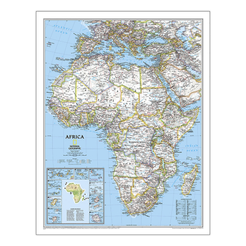
National Geographic Africa Classic Map, Laminated, 24in x 30.75in MPN:NGMRE00620142
Discount: See in Cart
Free Shipping
In Stock
Free Shipping
In Stock
SKU
312-3177686
National Geographic Africa Classic Map, Laminated, 24in x 30.75in MPN:NGMRE00620142
Explore the vast and diverse continent of Africa with National Geographic's authoritative map. Perfect for classrooms, offices, or home decor, this laminated map is durable and resistant to humidity changes. Its classic style and bright color palette make it easy to read and understand. Use it to learn about international boundaries, cities, islands, and physical features. Ideal for geography students, researchers, and travelers, this map provides an up-to-date and accurate representation of Africa's terrain and climate. Its heavy-duty laminate also makes it easy to frame without glass, creating a beautiful and informative addition to any space.
Top product features:
- Expertly researched and designed to provide accurate and authoritative information
- Signature Classic style map with bright, easy to read color palette
- Meticulously researched using multiple authoritative sources including the United Nations and policies of individual governments
Top product applications:
- Home Decor
- Office Wall Art
- Educational Resource
Expertly researched and designed, National Geographics Africa Wall Map is the authoritative map of Africa by which other reference maps are measured. Signature Classic style map with bright, easy to read color palette with blue oceans and colorful borders. Background shows mountain ranges and valleys in subtle shaded relief with mountain ranges labeled. Major water bodies including rivers, lakes, glaciers, oceans, seas, gulfs, bays, straits, and bathymetry. Clearly defined international boundaries, cities, islands, airports, and physical features. Thousands of place names carefully and artfully placed to maintain legibility in heavily populated areas. Up-to-date international boundaries and territorial control reflect de facto status on the ground. Meticulously researched using multiple authoritative sources including the United Nations and policies of individual governments. Accurate place names use a combination of conventional English names, official national names, and standard transliterations for non-Latin alphabets. Major landforms including deserts, lava fields, swamps, dry salt lakes, intermittent lakes, salt deserts, and areas below sea level. Inset maps of the 10 island nations surrounding Africa and climate and terrain topographic map of the continent. The map is encapsulated in heavy-duty 1.6 mil laminate which makes the paper much more durable and resistant to the swelling and shrinking caused by changes in humidity. Laminated maps can be framed without the need for glass, so the frames can be much lighter and less expensive. Countries shown include: Algeria, Angola, Benin, Botswana, Burkina Faso, Burundi, Cameroon, Cape Verde, Central African Republic, Chad, Democratic Republic of the Congo, Republic of Congo, Côte d-Ivoire, Djibouti, Egypt, Equatorial Guinea, Eritrea, Ethiopia, Gabon, Gambia, Ghana, Guinea, Guinea-Bissau, Kenya, Liberia, Libya, Madagascar, Malawi, Mali, Mauritania, Morocco, Mozambique, Namibia, Niger, Nigeria, Rwanda, Senegal, Sierra Leone, Somalia, South Africa, Sudan, South Sudan, Tanzania, Togo, Tunisia, Uganda, Zambia, and Zimbabwe. The island nations shown are: Canary Islands, Madeira Islands, Comoros, Seychelles, Mauritius, Rodrigues, Reunion, Sao Tome and Principe, Bioko, and Cape Verde.
Additional Information
- Country of Origin: US
- UNSPSC Code: 60101721
- UNSPSC Commodity: Professional teacher resource books
- Green: No
- Recycled Content: FALSE
- Hazardous: No
- Prop 65: No
- MSDS URL: nan
- Package Length: 25.00
- Package Width: 2.00
- Package Height: 2.00
- Package Weight: 0.10
Product info last updated on February 17, 2026 3:34pm UTC
Category: Instructional Resources